
Discover the most beautiful forest trekking route in Da Lat
A roughly 12-kilometer journey across undulating mountain terrain, winding through tranquil pine forests carpeted with golden dry needles, passing ancient trees and navigating steep, lingering slopes, has become a favorite route for trekking enthusiasts during the dry season in the Central Highlands.
Through the Pine Forest to the Summit of Mount Ba
At nearly 6 a.m., when we arrived at the foot of Lang Biang Mountain in Da Lat, thick mist still blanketed the forest entrances. After walking about 100 meters uphill, the fog gradually cleared. Looking back down, the valley below remained submerged in a sea of white mist, glowing softly under the pink light of sunrise—an almost surreal scene.
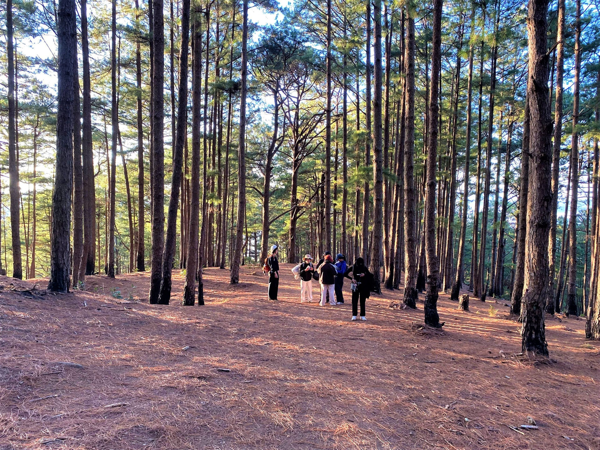
We began our climb along a wide dirt road used by locals to reach their farms, then turned onto a narrow trail that led past coffee fields blooming with fragrant white flowers. Ahead stretched a gentle but endless slope through the pine forest, where yellow pine needles covered the ground like a painted pathway.
“This is a very beautiful route up the mountain that mainly locals know about,” shared Le Hong Minh, a member of our group who has walked the trail for years.
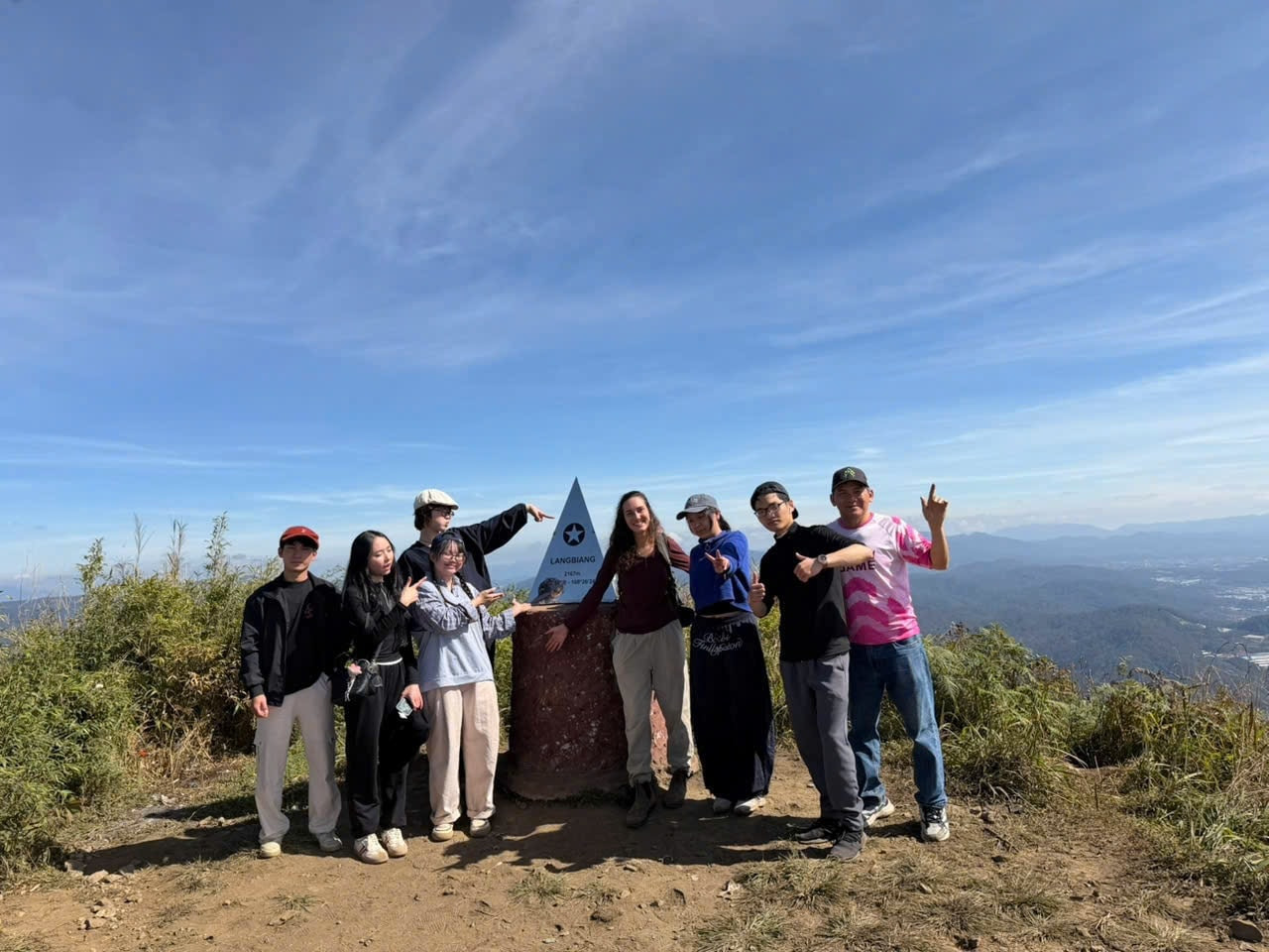
Located about 12 kilometers from central Da Lat, Lang Biang is considered the “roof of the city.” The mountain complex includes two main peaks: Mount Ong (Lang Biang) – 2,124 meters, and Mount Ba (Lang Biang) – 2,167 meters (the highest). Most visitors travel by vehicle to Radar Peak Lang Biang, which is lower, but serious hikers prefer the more challenging and scenic trek to Mount Ba.
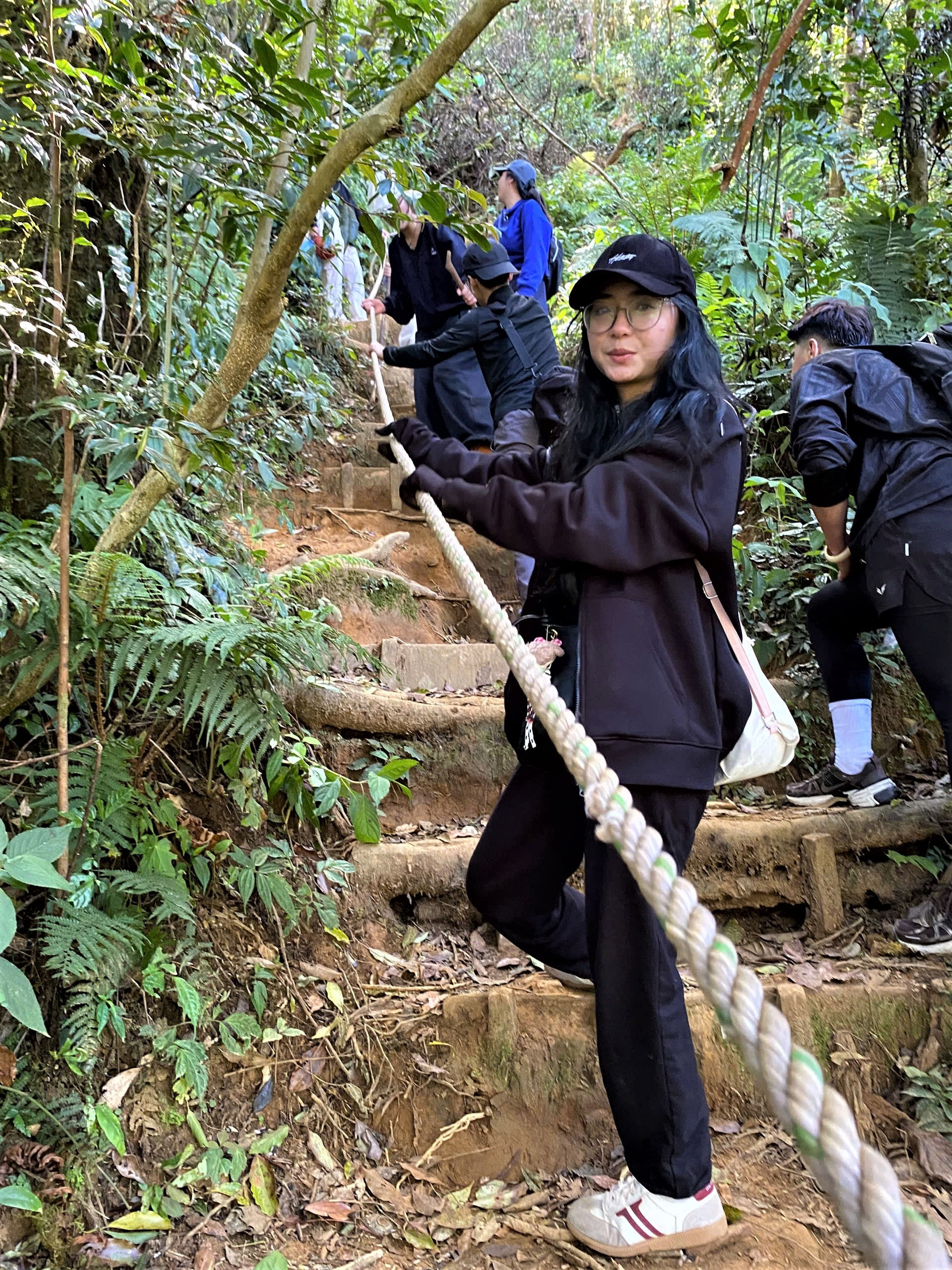
The trail leads hikers through pine forests and grasslands before entering the evergreen broadleaf forests of Bidoup – Nui Ba National Park, where towering ancient trees stretch skyward. Near the summit, steep staircases climb endlessly upward.
When the 2,167-meter summit marker finally appears, a breathtaking panorama opens up, with Da Lat faintly visible beneath drifting cold mountain mist.
Attract many visitors
Nguyen Binh An, a visitor from Ho Chi Minh City, has climbed the mountain several times. He recalled that during his first trip, his group underestimated the difficulty of the final stretch. Light rain had made the trail slippery, and they did not leave the forest until nearly 2 p.m.
“When we finally reached a roadside restaurant afterward, it was the most delicious meal of our lives,” he laughed.
Since then, the trail has captivated him. Every dry season, he returns to Da Lat with his family to hike the same route again.
The trail also attracts large, organized groups. During our climb, we met a local ethnic guide leading a group of 66 hikers from Ho Chi Minh City.
International travelers are also drawn to the route. Helen Man, a 21-year-old visitor from Israel, said she rented a motorbike early in the morning to reach the trail. “Da Lat is very beautiful, and this hiking trail is amazing. I love walking, so I came here to explore it myself,” she said.
According to Phan Duc Hung, Director of the Lang Biang Tourist Area, the hiking trail was designed and built between 2008 and 2009 by Bidoup-Nui Ba National Park to support community-based tourism.
The path is carefully maintained with clear signage, especially near the steep summit area where stairways and safety ropes assist hikers.
To promote the route, the Lang Biang Tourist Area and the national park have organized annual trail-running events and partnered with travel companies to offer trekking tours.
During the dry season (November to April), the trail receives more than 100 hikers per day. In the rainy season, visitor numbers drop, though adventurous international travelers continue to explore the route.
Visitors only need proper clothing, good hiking shoes, and should follow the trail signs while trekking through the forest.