


Western ring road Raises New Growth Hopes for Da Lat
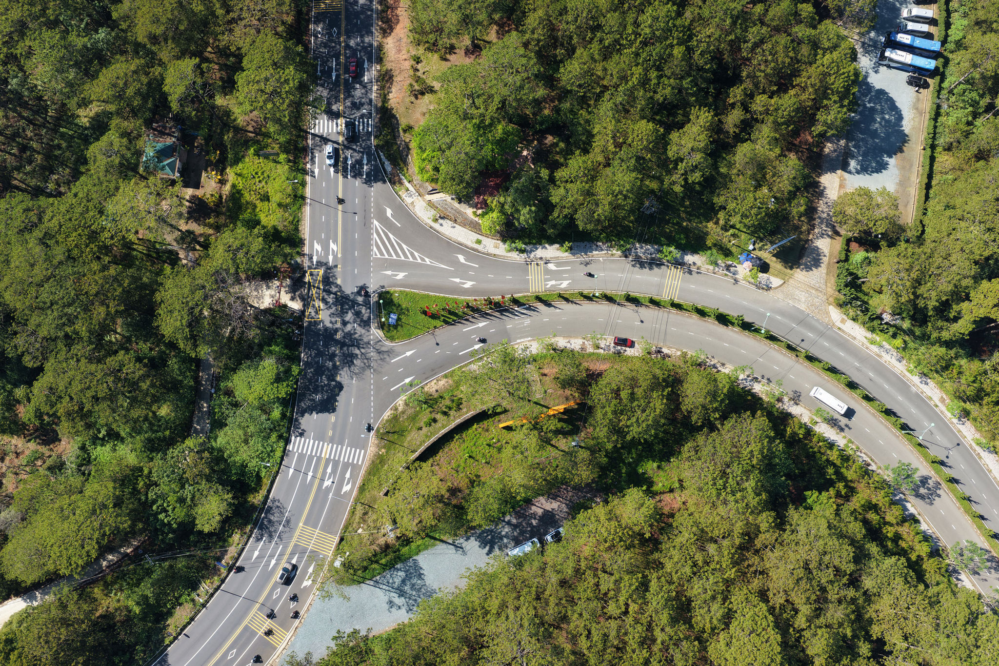
After nearly five years of overcoming major obstacles, the western ring road in Da Lat has officially opened to traffic, marking a significant step in easing traffic congestion in the western area.
Breaking the single-route dependence, driving decentralized urban growth
In early May, the Lang Biang Plateau welcomed the season’s first rains, refreshing the naturally cool atmosphere of the mountain city. It also marked the moment when the western ring road connecting southern and western Da Lat finally reached its most complete and modern appearance after years of construction.
Stretching approximately 7.5 kilometers, the route begins at the Prenn Pass–Truc Lam Yen Tu intersection and ends at the Nguyen Dinh Quan–Hoang Van Thu junction. Winding beneath pine forests like a soft ribbon, the road also connects a number of high-tech agricultural production areas on the outskirts of Da Lat.
Although minor issues remain at the final intersection, the new transport corridor has largely been opened, allowing vehicles to travel from Prenn Pass into downtown Da Lat through an alternative route. The project is expected to ease chronic congestion at the city’s busy 3/4 gateway.
The ring road features four mixed-traffic lanes, asphalt pavement, scenic stopping areas, modern lighting systems, sidewalks and reinforced concrete embankments, creating a transportation corridor designed for both safety and aesthetics.
For decades, Da Lat developed around a concentric urban model centered on the Hoa Binh area. However, rapid tourism growth and population pressure have left the city center increasingly crowded.
Against that backdrop, the western ring road is expected to support a more decentralized urban development strategy by opening up new growth space toward the western side of the city.
With a total investment of VND 870 billion, the project also holds strategic importance in linking major tourist attractions across the region. The route passes through the Tuyen Lam National Tourist Area, Truc Lam Zen Monastery and Bao Dai Waterfall before connecting to Van Thanh Flower Village, Cam Ly Waterfall and routes leading to Ta Nung, Nam Ban and the Lang Biang mountain area.
Concerns over landscape preservation
However, behind the excitement surrounding the project are growing concerns about preserving the natural landscape along the route. Nguyen Duy Lang, a retired official living in Da Lat, said that alongside the “golden opportunities” created by the new road, the area also faces major challenges in controlling construction activities and protecting green corridors.
He noted that local authorities would need stricter regulations on urban planning, construction and architectural design to ensure future developments remain harmonious with the natural environment.
For many residents and visitors, the biggest expectation is for the route to become a model green tourism corridor. Beyond serving transportation needs, the road could allow travelers to enjoy the scenic beauty of Tuyen Lam Lake and Da Lat’s signature landscapes, while experiencing the blend of modern infrastructure with forest tourism and agricultural tourism activities.
Although several final sections near the intersection area are still unfinished, the shape of a strategic transport corridor has already become clear. The project is seen as evidence of a long-term planning vision that places transportation infrastructure as a development driver while preserving landscape value as a core priority. Once fully completed, the western ring road is expected to help ease traffic congestion in central Da Lat and create new momentum for urban expansion toward the western areas.